This article describes the activation of the satellite irradiance values in the system configuration.
Please note:
The use of the satellite feature is associated with additional costs of 50,- Euro per year per data source from 01.06.2022 on. If you add a data source of the type "Meteotest satellite data API" to an installation in the portal, you agree that you will be billed for these costs at the end of the current calendar month. Billing will be on an annual basis. If the data source is deleted within a billing period, there will be no pro-rata refund.
1. Login with your Solytic account.
2. Select the site where you want to integrate the satellite data source.
3. Select on the left panel Site > Configuration > Datasources
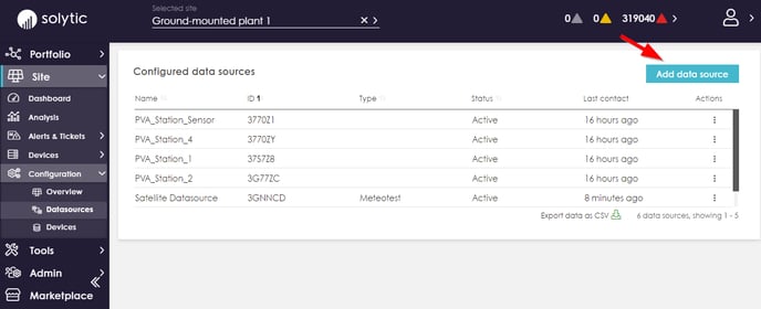
4. Click on the highlighted "Add data source" in the upper right corner.
5. The Editor opens.
First, select "Meteotest satellite data API" in the drop-down menu for the connection type.
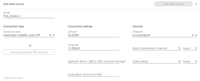
Fill in the following mandatory fields:
* Name (name of satellite data source e.g. "south orientation").
* Geodata (all in decimal format): latitude, longitude
* Azimuth
* Inclination (inclination angle of the modules)
* Time zone
Note: Please do NOT make any adjustments to the fields Data transmission interval and Data delay. If the system has different orientations of the module fields (azimuth), e.g. in the case of an east-west system, a corresponding number of satellite data sources can be created according to the number of orientations.
6. On the right side, click on the highlighted "Save" (or for customizations: "Change")
7. After approx. 30 to 60 minutes, a new device can be found under Site > Devices - > Sensors of type Satellite. The satellite device and its data can be displayed either under Site > Configuration > Devices or Plant > Configuration > Configuration overview.
8. Irradiation data is visualized on the portfolio and site dashboards.
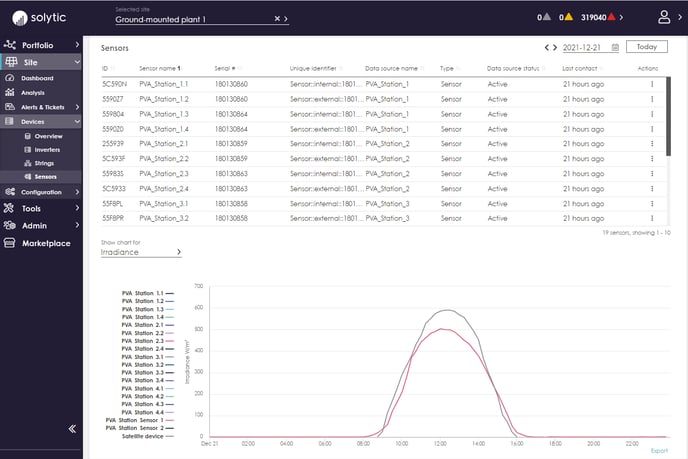
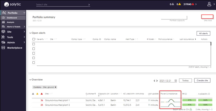
A comparison of the irradiation data with power and yield on plant level is possible. If other local sensors are installed, they can also be compared with the satellite data:
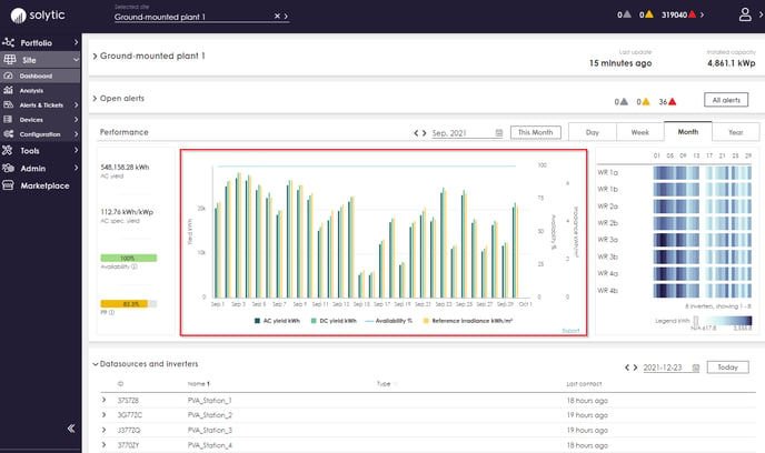
The satellite data is displayed on the site dashboard chart as "Sat. irradiance" and "Sat. tolerance". If more than one satellite device has been configured for the site, the average of the satellite irradiance is displayed. This is important for sites with different pv module orientations. If the satellite device was selected as the reference sensor, then the satellite radiation is used for the PR calculation.
Satellite data or sensor data for the PR calculation can be added in the menu under Site > Configuration > Add Data Sources. A detailed description can be found here.
